

Fishing Alamo Lake
AKA: Lake Alamo
![]()
![]()
![]()
Fish species to fish for...
Guide to fishing for largemouth bass, channel catfish, flathead catfish, black crappie, bluegill, redear sunfish and tilapia at Alamo Lake in Arizona.
By Rick Seaman
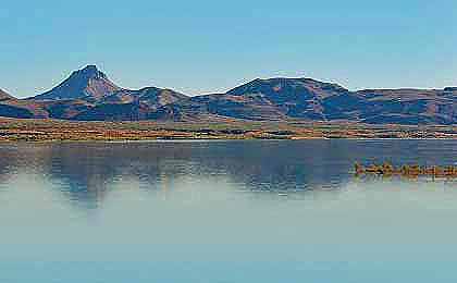
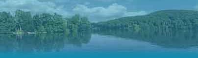
Located on the Bill Williams River in northwest Arizona, Alamo Lake is an easy 45 minute drive north on Alamo Dam Road from highway 60 at Wenden, AZ. When full, Alamo Lake is a 2,700-acre reservoir. However, the lake level fluctuates based on rainfall in the watershed. The Alamo State Park offers camping facilities with hookups, rest rooms and showers.
Alamo Lake, AZ Fishing In 2024
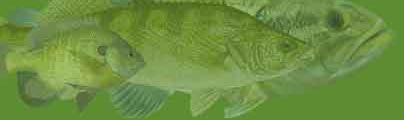
Bass Fishing At Alamo Lake
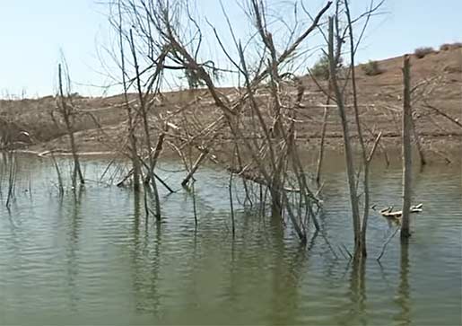
Alamo Lake is a haven for bass enthusiasts, offering quality largemouth bass fishing amidst a wide variety of types of cover. Standing trees, submerged brush, rocky shorelines, creek channels and off-shore structure are all potential hangouts for bass. The main boat launch is located in the southwest corner of the lake at Alamo State Park, which offers RV and tent camping with hookups and rest rooms. The Cholla Boat Ramp is also located in the park, mid-lake on the south side of the lake. At times, largemouth bass thrive in the lake's shallow, weedy areas, providing anglers with a chance to navigate the submerged vegetation especially around spawning season. Other times schools of bass can be found on deeper structure, usually following baitfish. Successful tactics for largemouth bass at Alamo Lake include using topwater lures, spinnerbaits, soft plastic worms, and jigs. The lake's fluctuating water levels add an additional layer of complexity, as the bass move outside during falling water levels and move inside during rising water.
Crappie Fishing
Alamo Lake offers a rewarding experience for anglers targeting crappie, a popular panfish species known for their delicious taste and cooperative nature. Crappie in Alamo Lake are often found near submerged brush and trees. Anglers can use techniques such as vertical jigging with small jigs or casting with live minnows to entice strikes from these schooling fish. The key for anglers is to locate crappie schools and then deploy their baits strategically. Catching crappie in Alamo Lake provides a delightful angling experience, combining the thrill of the catch with the satisfaction of reeling in these tasty panfish.
Catfish Fishing
Catfish present an exciting opportunity for both day and night fishing adventures. Channel catfish and flathead catfish thrive in the lake, particularly in deeper channels and near river channels and submerged structure. Anglers often use stink baits, cut bait, or live bait to attract these large predators. Whether casting lines from shore or venturing onto the lake in a boat, catfishing in Alamo Lake promises an opportunity to catch healthy catfish, and maybe one of monster size.
Alamo Lake, located in western Arizona, is a renowned destination for fishing enthusiasts seeking a thrilling and rewarding angling experience. This expansive lake offers abundant opportunities to catch a variety of fish species, making it a popular spot among both locals and visitors.
Lake Video
One of the main attractions of Alamo Lake is its impressive bass fishing. The lake is home to an excellent population of largemouth bass. Anglers can test their skills and techniques while targeting these prized game fish. Whether you prefer topwater lures, soft plastics, or crankbaits, Alamo Lake provides ample opportunities to reel in some impressive bass.
Bass fishing at Alamo Lake
Alamo Lake in Arizona is a renowned destination for bass fishing enthusiasts looking for a thrilling angling experience. The lake boasts an impressive population of both largemouth and smallmouth bass, making it a prime spot for bass fishing. Anglers can test their skills and techniques while targeting these feisty game fish, known for their aggressive strikes and powerful fights. Whether you prefer casting topwater lures in the early morning or working jigs and crankbaits along the rocky shorelines, Alamo Lake offers plenty of opportunities to hook into some trophy-sized bass. With its clear waters and ample fishing grounds, Alamo Lake provides an exciting and rewarding bass fishing experience for anglers of all levels.
The quantity and quality of the bass population varies from year to year, based on water levels in prior years. An advantage of the fluctuating water level is the abundance of brush and vegetation in rising lake levels. This plant matter enriches the water with nutrients and promotes growth of all levels of the food chain. Topwater, spinnerbaits and crankbaits are excellent choices when the bass are shallow. As the bass move to deeper water, as they do particularly in the heat of summer, jigs, spoons and drop shots are consistent producers.
In addition to bass, Alamo Lake boasts a diverse fish population. Catfish, such as channel catfish and flathead catfish, can be found in the lake's depths. Crappie and sunfish are also present, adding to the variety of species anglers can target. This diversity ensures that there is always something biting, regardless of your fishing preferences.
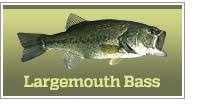
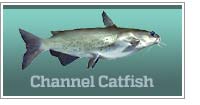
Primary fish species residing in Alamo Lake
Click images for fishing tips and details about each species.


![]()
Other Fishing
Plenty of catfish, crappie and a variety of sunfish also populate this lake. The annual, spring spawn moves crappie to the upper end of the lake where minnows and small jigs catch their share of nice crappie, many over two pounds. Catfish prefer the river channels and Alamo Lake often serves up some giants.
Alamo Lake Amenities
Marina: NO
Boat Rental: NO
Boat Launch Ramp: YES
Campgrounds: YES
RV Hookups: YES
Lodging: NEARBY
Convenience Store: NO
Bait & Tackle: NO
Restaurant: NEARBY
Today's Weather & Forecast
Boating is a popular activity at Alamo Lake, offering anglers and recreational enthusiasts the chance to explore the lake's vast waters. Both motorized and non-motorized boats are allowed, providing a range of options for boaters. Anglers can cruise around the lake, discover new fishing spots, and take advantage of the lake's ample fishing grounds.
Boat Launch Ramps & Landings
Cholla Launch Ramp
Located mid-lake on the east side of the lake on Cholla Road.
Main Launch Ramp
This is a paved ramp, located on the southeast corner of the lake near the Alamo Lake Visitor Center.
Click here for a Arizona Fishing License.
Camping facilities are available near Alamo Lake, making it an ideal destination for anglers who want to fully immerse themselves in the outdoor experience. The lake features a campground with sites suitable for both tents and RVs. Amenities such as picnic tables, fire pits, and restrooms are provided, ensuring a comfortable camping experience.
There are three main areas to camp: the main ramp campground (by the dam), Cholla Campground (mid lake) and Browns Crossing (in the upper end of the lake) which has no facilities and is often referred to as the "free zone".
Campgrounds & RV Parks Nearby
Alamo Lake State Park Campground - 928 669-2088
Other primitive camping areas are available near the lake.
Alamo Lake AZ Map - Fishing & Camping Areas
Contact Information
Alamo Lake
Alamo Lake State Park
Alamo Rd
Wenden, AZ 85357
928 669-2088
Rick Seaman is a bass fishing enthusiast with over five decades of bass fishing experience, a retired bass tournament fisherman and co-author of the book "Bass Fishing. It's not WHAT you throw, It's WHERE you throw it" .
Fishing lakes in each state.
Alamo Lake in Arizona.
ARIZONA
General Fishing Info

Information about camping and fishing lakes in AZ.
Alamo offers great bass fishing for anglers in the western part of the state.