Oregon Fishing Map
![]()
![]()
![]()


![]()
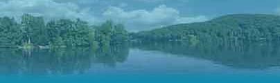
Interactive map plus a list of fishing lakes in OR.
Below the map is a list of major fishing lakes in Oregon.
Use the above map to locate these bodies of water and find the best fishing lakes in Oregon.
Agency Lake is a 7,200-acre lake in southwest OR.
Aspen Lake is a 2,500-acre lake in the southwest part of the state.
Beulah Reservoir is a 1,900-acre lake in east-central OR.
Bluejoint Lake is a 4,800-acre lake in the south-central part of the state.
Brownlee Reservoir is a 57-mile long lake on the eastern border of the state.
Crane Prairie Reservoir is a 5,000-acre lake in the central part of the state.
Crater Lake is a 15,000-acre lake in the southwest OR.
Crescent Lake is a 4,000-acre lake in west-central OR.
Crump Lake is a 3,200-acre lake in the south-central part of the state.
Davis Lake is a 3,000-acre lake in west-central OR.
Detroit Lake is a 3,500-acre lake in the northwest part of the state.
Diamond Lake is a 2,800-acre lake in southwest OR.
Drews Reservoir is a 1,900-acre lake in the south-central part of the state.
Fern Ridge Reservoir is a 9,000-acre lake in west-central Oregon.
Green Peter Lake is a 4,000-acre lake in the west-central part of the state.
Hart Lake is a 10,000-acre lake in south-central OR.
Lake Billy Chinook is a 3,900-acre lake in the central part of the state.
Lake Owyhee is a 14,000-acre lake in the east-central part of the state.
Odell Lake is a 3,600-acre lake in west-central OR.
Phillips Lake is a 2,200-acre lake in northeast OR.
Prineville Reservoir is a 3,000-acre lake in central OR.
Siltcoos Lake is a 3,200-acre lake in the west-central part of the state.
Tahkenitch Lake is a 1,600-acre lake in west-central OR.
Tenmile Lakes is a 2,000-acre series of lakes in the west-central part of the state.
Upper Klamath Lake is a 61,000-acre lake in southwest OR.
Waldo Lake is a 6,300-acre lake in the west-central part of the state.
Warm Springs Reservoir is a 4,600-acre lake in the east-central part of the state.
Wickiup Reservoir is an 11,000-acre lake in west-central OR.
Maps to find fishing lakes, by state.
Find major lakes and fishing waters in OR.
The purpose of this map is to help you locate major fishing waters in the state of Oregon, along with travel routes. If you have a favorite lake in OR which you would like to see added here, we would enjoy hearing from you. Contact us with details. If you offer a guide service on any of these lakes please visit our Oregon fishing guides page and consider adding your information.
OREGON